Let me share with you some software I use for flight planning and execution. Even though it seems that way, I don’t get paid for praising anything here!
There is even some software (-addons) I made myself. You can find them in the Download section.
SkyDemon
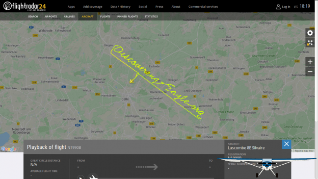
SkyDemon in action: With rain through the Scottish Highlands
Description
SkyDemon is a British made flight planning and navigation software for Android, iOS and Windows.
On one hand it provides flight planning, on the other it serves as an inflight navigation device. Since it is maintained quite actively, you will get updates and new features about every one or two months.
SkyDemon comes with its own aircraft database for performance and W&B calculations, but you also can customize these airplanes to your need or create completely new ones. It also contains an editor for the mapping data.
When you plan your route, SkyDemon automatically downloads all applicable NOTAMS as well as radar imagery, METARs & TAFs and GAFOR for your route and date of flight. As long as a forecast is available, obviously. 😉
When available you can even download airport diagrams and approach plates onto your device and overlay them on the default chart when you are in the navigation mode. Unfortunately the plate availability depends on the country you are looking it because some countries like France just publish their plates for free and the developers of SkyDemon can just use them. On the other hand, for example, Germany’s DFS has a strict copyright on all VFR charts so that even the Skydemon people have to pay for them. in that case, you can still use these charts but you have to pay an extra 55€ per year which probably go straight to the DFS.
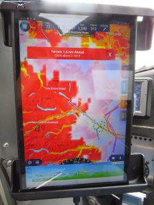
Also SkyDemon features a digital terrain database and optional terrain coloring like in the photo. By the way, the blue shadow is precipitation.
Of course, all theses data are updated in flight as long as you have an internet connection for you device.
Another feature I don’t wanna deny you: You can couple SkyDemon with different third party traffic sensors like FLARM or GDL90. Then it automatically uses their GPS signal and displays the position of other aircraft within the map. If you dare to come close to somebody else, you will get visual and aural alerts!
As mentioned earlier, SkyDemon runs on Android, iOS and Windows and you are allowed to use your subscription on up to two mobile devices and one PC simultaneously. With so many device it can become a nightmare to synchronize your settings, saved routes, airplane configurations and so on. But even there the SkyDemon developers found a solution: The integrated cloud! All your routes and flight logs will automatically be saved and opened from there. Additionally, you can also save and load you settings, custom mapping data, airplane configurations and user waypoints to/from this cloud.
Cost
The good thing first. You can get a free 30-day trial of SkyDemon on their website. With that you are allowed to use the software on up to two mobile devices (it doesn’t matter if it is Android and/or iOS) and one Windows PC simultaneously.
Shortly before your trial expires, you will get notified by email and if you choose to fully subscribe you need to pay 153€ for the first 12 months (08/2019) and 98€ (08/2019) for every subsequent subscription renewal. But beware that SkyDemon is a British company and behind the scenes they are working with British Pounds. So the prices will fluctuate according to the EUR-GBP course.
Features
- Inflight weather
- Traffic avoidance
- Terrain avoidance
- Approach plates
- Integrated cloud
- Multi platform
Fliegen-in-*.de
A very good source for trip planning are the websites of Philipp Tiemann. Philipp flies his Cirrus all over Europe VFR and IFR and has created some travel guides.
These guides start with specific aviation rules in said country like VFR minima, airspace structure and so on. He also includes entry and overfly requirements as well as needed paperwork.
Furthermore Philipp includes a section for flight planning where he describes were you can get your weather, charts or NOTAMS and with whom to file a flightplan.
But the biggest section actually is his travel guide. He usually breaks a country up into regions and for each region he points out airfields with good or bad service and with high or low fees. He also includes some advises what to explore once you are on the ground.
Unfortunately, his sites are only available in German. To visit a page, just click on the picture…


Google Earth
Probably everyone knows Google Earth today. But anyway, I like to address how useful it is for flight planning. I mainly use it to place markers for all locations I want to visit on a journey to figure out the best route to connect them.
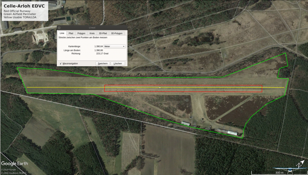
Measuring available runway in Google Earth
red: LDA, green: airfield perimeter, yellow: actually usable runway
I also use Google Earth quite extensively for departure and arrival planning. Especially on airfields with shorter runway I use the Google Earth Ruler to measure the real usable runway. The AIP only states the area between the marker cones (soft runway) but most times you have some more meters on both ends you can use. In this case I also check the satellite image for obstacles in the approach or departure path. Performance data for a 50ft obstacle are great. But what if the obstruction at the end of the runway is no tree but a fence. You see, with such detailed data, you can narrow down your calculation.
For the enroute portion of the flight I usually use Google Earth to check mountainous terrain to determine if I could pass overhead.
All that is done in conjunction with SkyDemon of course.
Google Earth Homepage